


The Glasgow Urban Nature map is BACK! Why not pair it with the Edinburgh map?
Printed on the same press as Ordnance Survey maps, it is a large-format (950 × 1270mm), high quality, folded map printed with a special Pantone spot ink – custom drawn to highlight all the places to explore on foot or by bike.
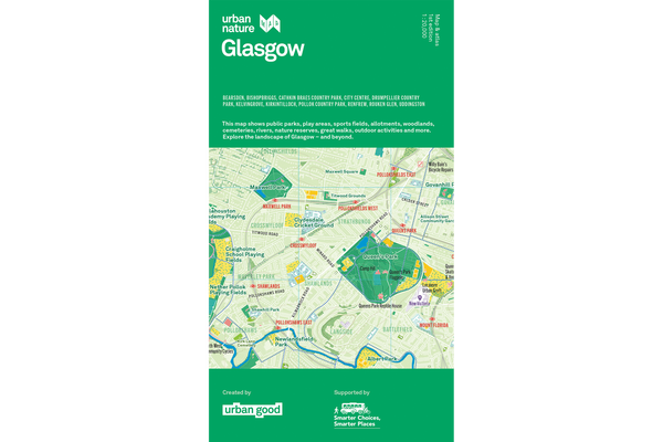
A little bit about this map
It shows Glasgow as a city of nature, bringing its green and blue spaces to the fore - its parks, woodlands, playing fields, nature reserves and rivers. It incorporates symbols marking places to walk and cycle and take in the city’s views. It shows open space rather than roads and buildings.
On the reverse is an atlas of information, graphics, and ideas. How is Glasgow's green and blue space used? How do its walking and cycling routes connect? How much does the River Clyde drop in height from its source? How might you bring ‘five ways to wellbeing’ into your work? What can you do for nature in your garden, on your street, or on your windowsill? Turn your map over and explore!
Urban Nature Glasgow aims to stimulate us to see the city differently: to think more deeply about the city as a place, and our place in it. It’s a resource to encourage more awareness and more action for people and nature…to help put nearby nature in everyday lives.
Co-created by Urban Good and Rob Bushby.
Funding Partners
Paths for All – Smarter Choices, Smarter Places
Glasgow City Council
Scottish Forestry.
Numerous supporters shared information and insights – please see the Credits panel. Thanks to all the individuals who helped bring this to life.
Links
➔ Resources and activities
➔ Blog
➔ Contact: Rob Bushby
For a flat print to hang or frame, click here.

Thank you for supporting Urban Good CIC.
ISBN: 9781916035591