



Use left/right arrows to navigate the slideshow or swipe left/right if using a mobile device


A pocket-sized walking atlas of Great Britain, made for planning journeys, joining up places and dreaming a little further.
Explore Great Britain on Foot
Open the atlas anywhere and start joining the dots. Find somewhere familiar, follow the connections to a neighbouring town, or plan a journey across a whole region. The maps make it easy to see how a small local walk could become part of something longer.
114 Pages of Maps
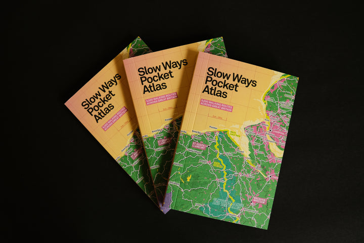
The mapping covers Great Britain, bringing walking connections, towns and landscapes together on the page. National parks and other distinctive landscapes stand out in colour, while named trails help you place your own plans in the bigger picture.
The Lake District and Solway Coast spread, shown in the photographs, is a good example: find Keswick, Penrith, Ambleside and Kendal, trace the links between them, and see how the network reaches towards Carlisle and the coast. The Pennine Way and King Charles III England Coast Path are also marked on this spread.
A Book to Make Your Own
Browse for an afternoon outing, plan a journey between friends, or colour in the places you’ve been. Photography and writing sit alongside the maps, giving you reasons to linger between trips. Its compact format makes it easy to take along or give to someone who loves walking, maps and exploring.
What Is Slow Ways?
Slow Ways is a community-created network of walking routes connecting Britain’s towns, cities and villages. Volunteers suggest, walk and review routes, contributing local knowledge and practical experience to a shared resource.
Use the Atlas Alongside the Website
The book gives you an overview of the network as published. Use the Slow Ways website alongside it for individual route details and reviews when planning a walk. Routes differ in terrain and accessibility, so check the information for your chosen journey. You can contribute your own experiences to help other people find their way.
Praise for Slow Ways
“A must-have for people who already walk and for those who want to walk more, for everyone who’s environmentally conscious and wants to tread more lightly, for map fans, history buffs and geographers, and for people curious about what the future could and should look like.”
— Mary-Ann Ochota, broadcaster and author
“The central idea is really large-scale infrastructural: to create a network of ‘slow ways’ between towns, villages and cities—tested, timed, shareable and usable—that can offer significant, practical and frequent sustainable alternatives to vehicle transport.”
— Robert Macfarlane, writer on landscape and people
“Every week on Ramblings I meet people who understand deeply the value of walking. Slow Ways is making it possible for more people to walk further and for more purposes, which is a great thing for the whole country and a legacy for future generations.”
— Clare Balding, presenter of the BBC’s Ramblings
“A brilliant way to squeeze nature, wildness and adventure around the busy margins of modern life. For everyone, everywhere.”
— Alastair Humphreys, author and adventurer
Publication Details
- Title: Slow Ways Pocket Atlas
- Authors: Hannah Engelkamp and Daniel Raven-Ellison
- Design and maps: Charlie Peel, Urban Good
- Publisher: Urban Good CIC
- Map coverage: Great Britain, with 114 pages of maps
- Printing: Printed in Great Britain by Generation Press on carbon-balanced paper
For more about the initiative or getting involved, visit Slow Ways or email hello@slowways.org.
ISBN: 9781914432163