


The Urban Nature Newcastle map is here!
Printed on the same press as Ordnance Survey maps, it is a large-format (950 x 1270mm), folded map – custom drawn to highlight all the places to explore and printed with a special Pantone ink.
If you would like the folded version, please click here.
A little bit about this map
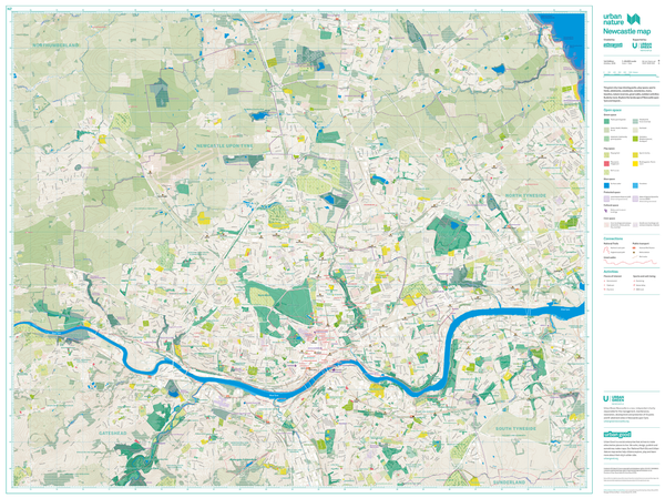
It shows Newcastle upon Tyne and the surrounding areas in detail as a green and blue landscape fit for exploration. The massive map includes all the parks, woodlands, playing fields, nature reserves, city farms, rivers, canals and all the spaces that contribute to the region's parkland. Some of the most iconic walks through and around the city are drawn, such as the Hadrian's Wall Path, along with symbols marking public art or landmarks.
The map was a collaboration with Urban Green Newcastle who manages 33 of the city's parks and over 60 allotment sites.
Connecting children and adults to nature, experiencing the benefits of green and blue space, finding play spaces and sports pitches, seeking out new trails, cycle paths, learning about biodiversity and where to look for all the above is why we made this map.
On the reverse is a giant atlas with ideas for explorations and information graphics to tell you more about the park. Don't forget to turn it over!
Thank you for supporting Urban Good CIC.