

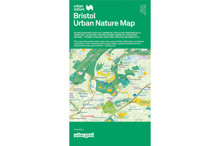


A folded map of Bristol – for walking, cycling, hiking and seeing the city differently.
Bristol Trails & City Hikes
This map highlights 18 key walking routes across Bristol and the surrounding countryside, divided into long distance regional paths and accessible city hikes.
Explore extensive trails, connecting Bristol to surrounding counties and coastal corridors:
- Forest of Avon Community Forest Path: A scenic network winding through community woodlands, heritage landscapes, and local green corridors surrounding the city.
- Greater Avon Way: A long distance path following the course and valleys of the River Avon across the region.
- Kennet & Avon Canal Trail: An iconic multi-use water-side route stretching eastward toward Bath and beyond along historic canal towpaths.
- Monarch’s Way: Follow portions of the historic 615-mile epic route tracing King Charles II's escape route through South Gloucestershire and Bristol.
- River Avon Trail: A tranquil walking route closely tracking the River Avon from the Avon Gorge near Pill right into central Bristol and Keynsham.
- Severn Way: A major river trail following the lower reaches of the UK’s longest river along the Severn Estuary coastline.
- Two Rivers Way: A peaceful rural walk linking the Chew and Yeo river valleys through countryside south of Bristol.
City Hikes (Urban & Suburban Walks)
Discover green loops and heritage trails right within the city boundary:
- Alan Burton Memorial Walk: A local commemorative route highlighting community green spaces and hidden suburban nature paths.
- Bristol Green Ring: An interconnected circular route linking the parks, nature reserves, and green spaces circumscribing Bristol.
- Bristol South Skyline Walk: Features panoramic views across the city skyline from South Bristol's elevated green hilltops and ridge parks.
- Bristol Triangular City Walk: A distinctive urban triangle connecting three diverse geological and architectural hubs across the city.
- Frome Valley Walkway: A linear trail tracking the River Frome as it flows from countryside glades right into the heart of urban Bristol.
- Nailsea Round: A popular circular route traversing countryside fields, commons, and woodlands around nearby Nailsea.
- Prior’s Wood: Known for vibrant spring bluebell displays, ancient trees, and deep woodland ravines in Portbury.
- South Bristol Circular Walk: A varied loop traversing urban parks, wildlife corridors, and community spaces across South Bristol.
- The Dramway: A historic path following the former 19th-century horse-drawn coal railway route from Coalpit Heath to the River Avon.
- Three Peaks Walk: A challenging local trek connecting three prominent elevated high points around the Bristol countryside fringe.
Map Specifications & Features
- Large Format Navigation: Measures 950 × 1270mm when unfolded—giving you an expansive, readable overview of the entire city and surrounding trails.
- Precision Printing: Printed on the same high specification press used for official Ordnance Survey maps.
- Vivid Fluorescent Inks: Uses specialized fluorescent print inks on durable paper engineered to withstand outdoor folding, marking, and bag storage.
- Reverse-Side Atlas: Features seasonal prompts, local wildlife tracking ideas, and open-ended urban adventure suggestions developed in community workshops.
- Limited Edition Flat Version Available: Numbered, hand-stamped, and embossed posters (limited to 100 copies), delivered unfolded and ready for framing.
Loved by the Local Experts
"Our city is criss-crossed by a network of wonderful blue and green spaces... This beautiful new map and guide offer, a welcome opportunity for residents to plan their next adventure."
— Cllr Martin Fodor, Chair of the Environment & Sustainability Policy Committee, Bristol City Council
"A beautiful map is never just something to look at — it's an invitation to get outside, wander further, and pay closer attention to the places we thought we already knew."
— Savita Willmott, Natural History Consortium (Festival of Nature)
"The Bristol map is a wonderful thing: joyful, surprising, and full of fresh perspective... I've seen first-hand the power of a big, colourful sheet of paper to help people see a familiar place in an entirely new way."
— Daniel Raven-Ellison, Founder of Slow Ways CIC
ISBN: 9781914432187